Dynamic chart
Doi Inthanon height, the summit and its twin pagodas
Twelve months at the top
The summit through the year
Choose a month to see the daylight and what to expect at the top of Thailand.
Sunset
Jan
- Sunset near 18:08
- Park season: Winter24
Frost days bring 0-4 degrees Celsius at the top in December and January.13
Mar
- Sunset near 18:36
- Park season: Summer24
Summer begins, yet the zone above 2,000 meters is temperate.24,8
Jun
- Sunset near 19:03
- Park season: Rainy season24
The rainy season starts; the forest above 1,800 meters is clouded and foggy for most of the year.14,24
Sep
- Sunset near 18:29
- Park season: Rainy season24
Rainy season in the park's calendar; the paths are wet.24
Oct
- Sunset near 18:04
- Park season: Rainy season24
The last full month of the rains in the park's calendar.24
Nov
- Sunset near 17:49
- Park season: Rainy season24
The rainy season ends here, and the cooler spell follows.24
Dec
- Sunset near 17:52
- Park season: Winter24
The mountaintop read 2.5 °C on December 19, 2025, and 3.0 °C on December 22; New Year's Eve brings visitors for the first light of the year.22,23,20
Sunset is worked out for the 15th of each month on Thailand's time. Season names follow the national park's own calendar; no weather station sits on the summit road, so the notes cite the park and the Thai Meteorological Department.
Thailand's highest point is reached by road, and the stops near the top are short and easy. Learn the height, what you see, how cold it is and how sunrise tours work.
Editorial team, doiinthanontour.top · Updated November 16, 2026 · 9 mins to read
Main facts
- HeightThe summit stands 2,565 meters above sea level, the highest in Thailand.1
- Next peakDoi Hua Mot Luang is next at 2,330 meters.2
- Twin pagodasTAT describes twin royal chedis standing amid the hills.3
- ColdA winter morning at the summit measured 5°C.4
- SunriseTAT says mornings bring golden light over a sea of mist.5
How high Doi Inthanon really is
The park states that the Doi Inthanon summit stands at 2,565 meters above sea level and is the highest summit in Thailand.1 TAT's winter feature gives the same figure and calls the mountain the Roof of Thailand, the highest point in the country.6 Whichever source you read, the number is the same, which makes it easy to quote. It is a figure worth knowing before you go, because it tells you to expect cool air and thin cloud at the end of the road, even when the lowlands are hot.
The park as a whole is a staircase. The land it covers climbs from 400 to 2,565 meters above sea level, so a single drive crosses a huge vertical range.1 Next in height comes Doi Hua Mot Luang at 2,330 meters, while Doi Hua Mot Noi reaches 1,900 meters and Doi Hua Suea 1,881 meters.2,7 Those lower summits are not the destination of a day tour, but they give a sense of how the ridge rolls on beyond the summit you can drive to.
That range explains the weather and the plants as well as the views. The park describes a temperate climate above 2,000 meters and says the highest slopes are wet and cold through the year.8 If you search for Doi Inthanon height, remember the useful lesson behind the number: the top of the road is a different world from the town you left. Dress and plan with that in mind, and you will enjoy the contrast between the warm foothills and the cool, damp forest higher up.
The top, stop by stop
What you will see near the summit
| Stop | What it is | Note |
|---|---|---|
| Summit marker | Thailand's highest point | 2,565 meters1 |
| Twin pagodas | Royal chedis | A fee of THB 100 on one listing |
| Ang Ka trail | Short boardwalk | 360 meters |
| Kew Mae Pan | Ridge nature trail | Around 2,000 metres12 |
| Viewpoint | Sea of mist in cool months | Morning light5 |
Heights as the park and TAT state them; the fee is a listing figure for the option without the park fee included.1
Getting to the top of the road
The summit is reached by road, and the drive is part of the day. The park describes the route from Chiang Mai along Route 108, a turn onto Highway 1009, and the entrance at milestone 8, with the headquarters at milestone 31.10 From the headquarters the road keeps climbing toward the highest ground. Keep an eye on the roadside markers as you climb, since they are the easiest way to tell how far you have come and how long is left.
Expect a drive of around 90 minutes from the city, TAT says.9 That 2021 note also listed the park as open 05.30 to 18.30 daily, with adults paying 300 Baht and children 150 Baht, so check today's figures before you plan a very early arrival.11 Plan your timings around the opening hours and the light, and keep a little flexibility for traffic on the road. Allow extra time at the gate if your visit falls on a holiday weekend.
An organised day tour combines the drive, the stops and a guide in a single booking. The site tour lasts 9 hours and includes the Ang Ka trail, a grand pagoda, the Mae Klang Luang village stop and Wachirathan Waterfall, from $38, with free cancellation until a day before departure. Self-drivers will find the same stops along the same road. On the way, the road passes waterfalls, villages and viewpoints, so even a simple drive turns into a varied day with plenty of places to stop and look.
Height ladder
How high the peaks stand, in meters
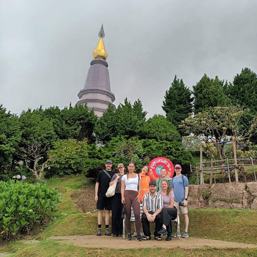
The twin pagodas near the summit
The twin pagodas of Doi Inthanon National Park stand near the top, and TAT lists admiring the twin Royal Chedis standing amid the hills as a highlight of the area.3 Listings spell their names in several ways, from Naphamethanidon and Naphapholphumisiri to Nabhapolbhumisiri, so match them by the pair rather than by one spelling. Photographers enjoy the terraces and the views over the hills from the pagodas, and the soft light of the early hours suits the pale stone and the gardens.
A dress rule applies at the pagodas. One listing asks visitors to the two chedis to dress in a casual code or better, with no tank tops and no short pants, and another says shoulders and knees must be covered. A long-sleeved top and long trousers handle both the cold and the rule, which suits the top of the mountain well. Carry a light scarf or a long-sleeved top, since the dress rule asks for covered shoulders and knees, and the day is cool anyway.
The site listing says that, without the fee-included option, the park entry fee is THB 300 and the twin pagoda fee is THB 100. Ask your operator whether the pagoda ticket is part of the price you pay, because it varies by option. Keep small notes for the gate, and allow time for photographs from the terraces. The pagodas are places of respect, so speak quietly, keep your hat off indoors and follow the lead of your guide on where to stand and when to take photographs.
Pick your summit
Which top-of-Thailand plan suits you
Choose what matters most about the summit and see the plan to match.
If I want the highest point and the pagodas
The site tour
It covers the pagoda and the Ang Ka trail in 9 hours.
If I want sunrise
A sunrise tour
A small-group sunrise tour lasts 10 hours.
If I want a private sunrise
The private sunrise day
It runs 8 to 10 hours with hotel pickup.
If I want a short walk only
The Ang Ka boardwalk
It is 360 meters long.
If I want stars and a night near the top
The overnight program
It lists stars at night as a highlight.
Ang Ka and the high forest at the summit
A short walk starts beside the summit road. Tourism Thailand's name for the Ang Ka Nature Trail is the gate to the Himalayan Range, where temperate native plants grow in old forest.15 The site tour puts the boardwalk at 360 meters and says it is no full hiking trail, so almost anyone can walk it. A raised walkway keeps your feet clear of the wet ground, and it makes the summit stop easy to walk for a wide range of ages and abilities.
The park explains where the name comes from. Beyond the summit lies a basin-shaped pond about 300 m to the west, and the term Ang Ka comes from the Karen Paganyaw language, where it means big.16,17 The mountain was once known as Doi Luang or Doi Ang Ka, names that tell you how the villagers saw it. Slow down here after the drive, hunt for orchids and ferns among the moss, and listen for birds overhead.
The park also records a rare plant here. Rhododendron simsii grows at the edge of the swamp forest and is found only on the summit of Doi Inthanon.18 Tourism Thailand describes moss-covered, mist-blanketed forest that feels otherworldly.19 Walk slowly, read the boards, and enjoy the quiet, since the walk takes only a few minutes. A good guide will point out the plants as you go, and the boards along the walkway explain what you are looking at if you are exploring by yourself.
Price the top
Compare tours that reach the summit
Choose a group size and compare summit day tours.
4 options compared
Compare tours that reach the summit
Choose a group size and compare summit day tours.
- Site eco day9 hours · per individual from $38
≈
View - Park and waterfallsShared van · per individual from $36
≈
View - Sunrise small group10 hours · per individual from $116
≈
View - Kew Mae Pan hike11 hours · per individual from $59
≈
View
Starting prices as on the booking platform, converted at the ECB reference rate. You see the exact price at booking.
Sunrise day
From the hotel to the summit and back
Pre-dawn
Pickup in Chiang Mai
Sunrise listings lift guests early; the drive is around 90 minutes.9
Sunrise
Golden light over the mist
Mornings glow over a sea of mist.5
Morning
The twin pagodas
Royal chedis stand near the top.3
Late morning
The Ang Ka boardwalk
A short walk of 360 meters.
Afternoon
Wachirathan Waterfall
A sunrise listing names the waterfall among its stops.
Sunrise at the top of Thailand
TAT paints the summit mornings as golden light on a sea of mist, with evenings bringing the last warm light before sunset.5 Around New Year's Eve, visitors flock to the summit to wait for the first light of the year.20 A sunrise visit is possible, and it needs an early alarm. If you are staying in Chiang Mai, an early start the night before makes the morning easier, and a flask of something hot from the hotel makes the wait for the light more pleasant.
A Doi Inthanon National Park sunrise tour is sold by several listings. A small-group sunrise tour of 10 hours, limited to 10 participants, adds a hike through rainforest, rice fields and a flower garden, plus local coffee and a local lunch, from $116. A private sunrise day of 8 to 10 hours with hotel pickup lists the two pagodas, the Ang Ka trail and Wachirathan Waterfall, from $89 for the private group. Compare the two on length, group size and what each adds to the sunrise, since the extras decide how the day feels more than the sunrise itself does.
Get the pickup time in writing, as the sunrise hour moves through the year and the drive takes around 90 minutes.9 Allow for a stop at the park gate. TAT's 2021 note listed opening from 05.30, so a pre-dawn plan should be checked with the park office or the guide.11 If the clock matters to you, ask the operator for a written pickup time and a plan for cloud, and keep a flexible attitude to the exact moment of the sunrise.
Video
Waterfalls, twin chedis and the highest point of Thailand
Hike For Happiness on YouTube · Video data is requested only when you tap play.
Mornings are bathed in the golden glow of the rising sun over a sea of mist
Summit checklist
What to know before the top
Wear3
Bring3
- Baht for the gate: TAT's 2021 note gave THB 300 for an adult11
- Your pagoda ticket if not included; one listing says THB 100
- A flask of something hot
Cold, wind and cloud on the summit
On a cold morning a TAT writer measured the summit at 5°C against 24°C in the city, and saw Mae Khaning, a delicate frost, on the grass.4,21 That is the scale of the change, and it is why a jacket belongs in the bag. The contrast with the city is part of the experience, so a jacket, a hat and warm socks belong in the bag from the start of the journey. A thin base layer under a warm top is the combination that works best.
The park warns that the summit can have gale-force winds and subfreezing temperatures, with 0-4 degrees Celsius on the frosty days of December and January.13 The weather service measured 2.5 °C over the mountaintop on December 19, 2025, and 3.0 °C on December 22.22,23 Sorted by the park's calendar, the cold belongs to winter, which runs December to February, while the rains fill June to November and summer covers March to May.24 Bring a hat, gloves and a windproof layer for December to February. Even outside the coldest weeks, the high ridge is breezy, so a light windproof layer is worth carrying all year, and it folds small enough to fit in a daypack.
According to the park, the forest above 1,800 meters sits in cloud and fog for most of the year.14 That means a clear view is welcome but never guaranteed. If the summit is white when you arrive, walk the Ang Ka boardwalk, visit the pagodas, and come back to the viewpoint once the cloud lifts. Cloud and mist are also part of the beauty, so enjoy the atmosphere, take your photographs of the forest in the fog and trust that the sky may open for a few minutes.
Picking a summit day
For the plainest summit day, book the site tour: a 9 hour loop with the boardwalk, the grand pagoda and the Mae Klang Luang and Wachirathan stops. A shared-van day with waterfalls and lunch adds the highest point and the two pagodas, with the park fee included or excluded by option. If you like to travel at your own pace, a private driver for the day is another option, though the listings above are the ones this site has checked for stops and prices.
If you want more time on the mountain, look at a listing with a trek, such as the 11 hour Kew Mae Pan hike day that stops at the pagodas first. The sunrise listing starts higher than the site tour, and a two-day program listed in the park is a way to stay near the top overnight, from $170. The longer stays suit travellers who want to see the night sky or walk a trail at dawn without the drive, and they let you spread the sights over two calmer days.
Whichever you choose, check cancellation first. Each listing here offers free cancellation up to 24 hours in advance. The weather is the one thing a booking cannot guarantee, so choose a flexible slot, dress in layers, and treat the summit view as a bonus rather than the whole reason for the day. Before you pay, check the meeting point, the pickup window and the language of the guide, and tell the operator your hotel and a phone number that takes messages.
FAQ
Questions answered quickly.
What is the summit elevation?
The park gives 2,565 meters above sea level for the summit, the highest in Thailand.1
Which peak comes next in height in the park?
It stands at 2,330 meters above sea level.2
How cold is the summit?
What are the twin pagodas?
TAT lists the twin Royal Chedis as a highlight of the area.3
Is there a fee for the pagodas?
The site listing says the twin pagoda fee is THB 100 if the fee-included option is not chosen.
Can you watch the sunrise from the summit?
Sunrise tours are listed, and TAT describes golden morning light over a sea of mist.5
Is the Ang Ka trail a hike?
The site listing gives 360 meters and says it is not a full hiking trail.
Sources
- Department of National Parks, Wildlife and Plant Conservation · Doi Inthanon National Park (park page, archive copy) ↩
- Department of National Parks, Wildlife and Plant Conservation · Doi Inthanon National Park (park page, archive copy) ↩
- Tourism Authority of Thailand (TourismThailand.org, archive copy) · Five of the most beautiful viewpoints in Thailand in 2025 ↩
- Tourism Authority of Thailand (TAT Newsroom) · A Survivor's Guide to Winter in Northern Thailand ↩
- Tourism Authority of Thailand (TourismThailand.org, archive copy) · Five of the most beautiful viewpoints in Thailand in 2025 ↩
- Tourism Authority of Thailand (TAT Newsroom) · A Survivor's Guide to Winter in Northern Thailand ↩
- Department of National Parks, Wildlife and Plant Conservation · Doi Inthanon National Park (park page, archive copy) ↩
- Department of National Parks, Wildlife and Plant Conservation · Doi Inthanon National Park (park page, archive copy) ↩
- Tourism Authority of Thailand (TAT Newsroom) · Doi Inthanon National Park and its sea of mist reopens to visitors ↩
- Department of National Parks, Wildlife and Plant Conservation · Doi Inthanon National Park (park page, archive copy) ↩
- Tourism Authority of Thailand (TAT Newsroom) · Doi Inthanon National Park and its sea of mist reopens to visitors ↩
- Tourism Authority of Thailand (TAT Newsroom) · TAT highlights SIRIVANNAVARI collection inspired by Kew Mae Pan Nature Trail ↩
- Department of National Parks, Wildlife and Plant Conservation · Doi Inthanon National Park (park page, archive copy) ↩
- Department of National Parks, Wildlife and Plant Conservation · Doi Inthanon National Park (park page, archive copy) ↩
- Tourism Authority of Thailand (TourismThailand.org, archive copy) · Mountain Savouring the Greens at Doi Inthanon, Chiang Mai ↩
- Department of National Parks, Wildlife and Plant Conservation · Doi Inthanon National Park (park page, archive copy) ↩
- Department of National Parks, Wildlife and Plant Conservation · Doi Inthanon National Park (park page, archive copy) ↩
- Department of National Parks, Wildlife and Plant Conservation · Doi Inthanon National Park (park page, archive copy) ↩
- Tourism Authority of Thailand (TourismThailand.org, archive copy) · Mountain Savouring the Greens at Doi Inthanon, Chiang Mai ↩
- Tourism Authority of Thailand (TourismThailand.org, archive copy) · Five of the most beautiful viewpoints in Thailand in 2025 ↩
- Tourism Authority of Thailand (TAT Newsroom) · A Survivor's Guide to Winter in Northern Thailand ↩
- Thai Meteorological Department · Monthly Weather Summary in Thailand, December 2025 ↩
- Thai Meteorological Department · Monthly Weather Summary in Thailand, December 2025 ↩
- Department of National Parks, Wildlife and Plant Conservation · Doi Inthanon National Park (park page, archive copy) ↩